We are nearing the half-way point of our project, which is a
good moment to take stock of goals and progress. Our focus has been on
identifying artifacts and features related to Governor Richard Moore’s roughly
two-month occupation of Smith’s Island, which we hypothesize was located on the
Smallpox Bay peninsula. Finding
convincing evidence should be a rather straightforward task of identifying
patterns of post holes cut into Bermuda’s native bedrock that resemble
contemporary domestic construction techniques employed by Virginia Company
settlers at Jamestown and reflecting typical English vernacular architecture. To do this in Bermuda, however, requires full
excavation of a large expanse entirely by hand, since no mechanical graders are
on island, let alone transportable to Smith’s Island by barge. The ground penetrating radar survey conducted
in April covered a fairly large expanse that we cleared of dense Mexican Pepper
and Allspice trees (and which fought us tooth and nail in the clearing), but
this data was suggestive rather than definitive. In short, there is no substitute for
old-fashioned digging by trowel, one meter square at a time across a 15-meter
by 15-meter grid – and then some.
 |
| My admittedly analog plan of Locus B, south of the standing stone ruin site |
As has been the case in the past, the two stratigraphic layers covering the site are yielding a mix of 1960s-1970s metal and plastic agricultural trash associated with the hydroponics operations (including apparently a waste burning site, given the amount of melted plastics appearing), late 18th- and 19th-century military and domestic material related to epidemic-related occupation of the site, and early 17th-century material, with little in between artifact-speaking.
Some distinct
patterning is emerging – larger concentrations of plastics in the southeastern
part of the Locus grid and a fair bit of early material in the southwestern
units excavated so far. Soil thickness
ranges from a mere 3-4 inches just south of the stone ruin to more than a foot
at our new grid’s edge, some 12 meters to the south. The SIAP diggers are getting fairly good at
differentiating finds now and know which artifacts usually make me squeak with
happiness or groan with frustration.
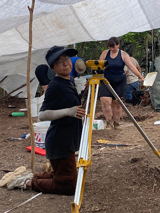
It has also been a joy to watch everyone not only fall into the rhythm of methodical fieldwork but also now differentiate layer changes and potential features on their own, lay out new squares, set up and use the datum level, fill out context forms, take context transition photos and elevations, and otherwise function like professional archaeologists. Covid closures of field schools over the past two years robbed them of the typical training students get, so it is wonderful to see them internalizing archaeological practices so quickly. A few still tend to “bowling” (not squaring up their unit sidewalls, creating a bowl rather than a box as they excavate deeper) but no one has blown through a layer change or dug out a feature’s fill.
I have Ewan and Peyton largely to thank for this – they have been attentive supervisors and patient mentors in working with the students under them and stayed on top of recording and documenting our progress. Everyone working on the site has proved committed and dedicated – and fun!
 |
| Team Trowels & Tribulations |
 |
| Team Precious Darling Snapdragons |
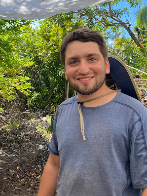
Here are this year's team members:
 |
| Peyton |
 |
| Xander & Ewan |
 |
| Hannah |
 |
| Jared |
 |
| Sammi |
 |
| Katie |
 | |
| Wyatt |
 |
| Mona |
 |
| ...and Sophia |
 |
| Crouching Sadie |
Sadly we just lost The Brits, who had to go back to do something as boring and irresponsible as writing masters’ theses to get degrees. We will miss them, especially DJ Katie Kate’s music and energy, Sadie’s ability to dig perched on exactly 16 square inches of dirt, Wyatt’s knack for taking the Mick out of Xander, and of course Xander, who grows with each excavation we do together.
 |
| Multiple overlapping features, extending into adjoining units |
As is often the case, on one’s last day at a dig, strange sh*t usually happens and Sunday was no exception. Guided by GPR data that suggested a deep anomaly, a test unit that Wyatt and Megan dug exposed a very large feature extending both south and east, requiring us to open up those units as well to fully understand the feature’s dimensions. We have up until now only found post holes of various sizes, so this new find is quite exciting and a bit of a mystery. A very large Fiddlewood tree seems to be growing in the feature’s center which will make excavation a challenge, but we should know by Friday what's going on.

I have been favoring chainsaw over trowel lately to clear roots and trees and also open up the area surrounding Smallpox Bay - to such a degree that Peyton made this (TBH accurate) meme:

By channeling my engineering daughter Katie, I have had fun building a floating dock at Smallpox Bay so we can load and unload right at site (saving us the long walk across Smith’s Island).

 In the days ahead, we look forward to hosting several VIP
guests and giving tours, starting with the Bermuda National Trust’s Dirt Diggers
Camp kids tomorrow – perhaps my future team members – and Bermuda’s Minister of
Culture, Youth, and Sport next week. There
are still plenty of squares to dig in the next two weeks, so if you are on
island and interested in helping us make (or at least uncover) history, send me
an email!


Comments