Breaking Ground
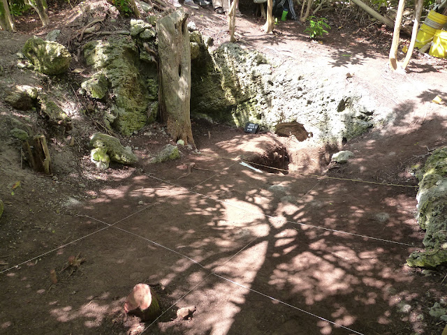
So... yesterday was all about setting up the meter square units we will be excavating:
Today we set to work on taking off the first layer. The shade you see here vanished by mid-morning and the roots in the nearest square were ornery. For the most part, the only artifacts were rusty bits that had fallen off an enormous metal tank on wheels used in the hydroponics operation here in the 1970s and 1980s, mixed with bits of plastic tarp - the students were not impressed. But about 6-10 cm down, large amounts of stone rubble began to appear (the top of the next context) and a few 19th c. ceramic sherds and nails turned up. We also worked through filling out the many details on the context register sheets (vital because archaeologists destroy their site as they dig it, and extensive paperwork is the only way to ever reconstruct the stratigraphic relations), using the Munsell book (for uniformly identifying soil colors), wrestling with sifters, and taking elevations using a water level (a laser transit wasn't in my budget - but hey, if it worked for Galileo, it can work for us). By the end of the day, we were close to finishing the layer but not quite - which got everyone out of lab duty that evening.
Here's the team:
...With Mike missing as the photographer. We were not that clean by the end of the day!
Action shots soon - as soon as I can find the cable to connect my other camera...
Today we set to work on taking off the first layer. The shade you see here vanished by mid-morning and the roots in the nearest square were ornery. For the most part, the only artifacts were rusty bits that had fallen off an enormous metal tank on wheels used in the hydroponics operation here in the 1970s and 1980s, mixed with bits of plastic tarp - the students were not impressed. But about 6-10 cm down, large amounts of stone rubble began to appear (the top of the next context) and a few 19th c. ceramic sherds and nails turned up. We also worked through filling out the many details on the context register sheets (vital because archaeologists destroy their site as they dig it, and extensive paperwork is the only way to ever reconstruct the stratigraphic relations), using the Munsell book (for uniformly identifying soil colors), wrestling with sifters, and taking elevations using a water level (a laser transit wasn't in my budget - but hey, if it worked for Galileo, it can work for us). By the end of the day, we were close to finishing the layer but not quite - which got everyone out of lab duty that evening.
Here's the team:
 |
| Kristina, Mimi, Leigh, Me, Jordan, and Quarin |
Action shots soon - as soon as I can find the cable to connect my other camera...


Comments